• Skip to primary navigation
  • Skip to main content

The Tevis Cup

100 Miles - 1 Day - Trail Ride

  • THE RIDE
    • Ride Day Links
    • 2025 Ride
      • Entering The Ride
      • Preliminary Entrant List
    • Planning for the Ride
      • Ride Dates
      • Rider Resources
      • Vet Check Maps
      • Checkpoint Locations and History
    • Crews and Spectators
      • Where to Watch?
      • Crew Guide
      • Checkpoint Locations and History
    • Volunteering
    • Historical
      • RESULTS (1955-present)
      • Buckle Recipients
      • Past Cup Winners
      • Facts and Figures
      • Tevis Forums
      • Videos
    • Tevis Photographers
    • Flickr Photos
    • Tevis Facebook
    • Tevis YouTube Channel
    • Sponsors
    • Rules & Policies
  • THE TRAIL
    • The Trail
    • Checkpoint Locations and History
    • Videos of the Tevis Ride and the Western States Trail
    • Tevis Trail FAQ
    • Vet Check Maps
    • Pre-Riding the Tevis Trail
    • Trailwork Days Sign Up
    • How to Help with Trail Maintenance
    • Granite Chief Wilderness – Trail Reroute
  • EDUCATION AND TRAINING
    • Virtual Tevis Cup 2025
    • Trail to the Trail
    • Tevis Training Ride Weekend
      • Tevis Training Ride 2025 Entry
      • Tevis Training Ride 2025 – Entrants
    • Educational Videos
    • You Can Do It!
    • Sweat – and How to Save It
  • WSTF
    • WSTF Board
    • Dru Barner Award
    • Annual Reports
    • Equine Welfare Studies
    • Tevis Forums
    • Where Does All the Money Go?
    • Rules & Policies
    • Copyright Information
    • Contact Us
  • DONATE
  • TEVIS STORE
  • PAST POSTS
  • Show Search
Hide Search

Deadwood

A welcome brief respite after the first canyon -  Deadwood (4,240 ft)
You might have only come 4 miles since Last Chance, but many rider+horse teams look a little shell shocked emerging from the canyon. The trail descends 1,800 feet to Swinging Bridge, before climbing 1,640 feet up to Devil’s Thumb.  Many riders opt to give their mounts a break and hand-walk down the canyon, and the really intrepid will tail them back out the more than 30 switchbacks up the narrow trail. Most will take time in the creek below the bridge to cool off before starting the ascent. Just before you crest the edge of the canyon, you may glimpse the “Thumb” - a nearly 50 ft tall volcanic outcropping off to your left. Cool your horse again at Devil’s Thumb, but you need to move on another mile down the trail to Deadwood for a 64 pulse gate-and-go vet check.  This unlikely trail was once a toll route between Michigan Bluff and Last Chance. The toll was collected by the Fergusons who owned the hotel and bar in Deadwood, and the proceeds used to keep the trail in good condition. Since 1992 this section has been listed on the National Register of Historic Places.

On June 19th to 24th 2016, the American Trail Running Association partnered with the Google Maps team to capture 360 degree panoramic “street-view” imagery of the entire Western States Trail using the Street View Trekker backpack:
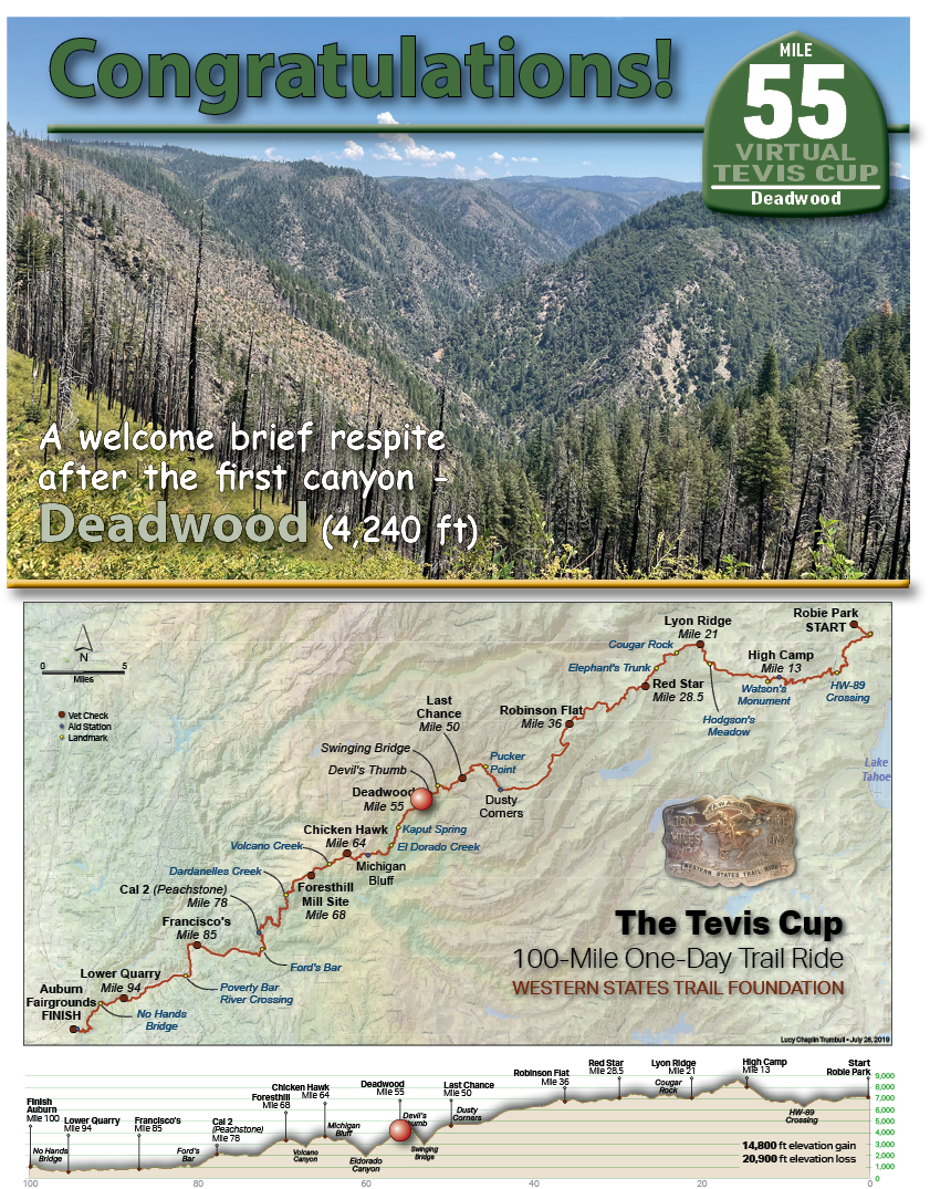
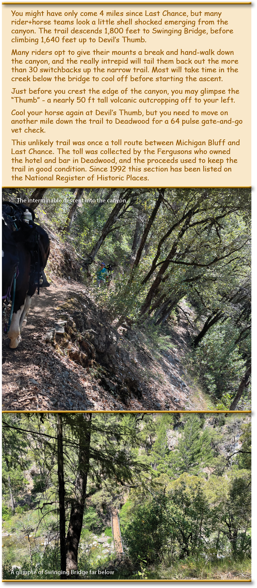
Devil’s Thumb

TEVIS QUICK LINKS

The Ride
The Ride
Ride Entry
Rider Resources
The Trail
WST Map
Volunteering
Trail Work Sign Up
Education & Training
Educational Events 2025
Virtual Tevis Cup
Bits and Bobs
Archives
Sponsors
Vendor Registration
Contact Us
WSTF@teviscup.org
(530) 823-7282

The Tevis Cup

Copyright © 2025 · Log in