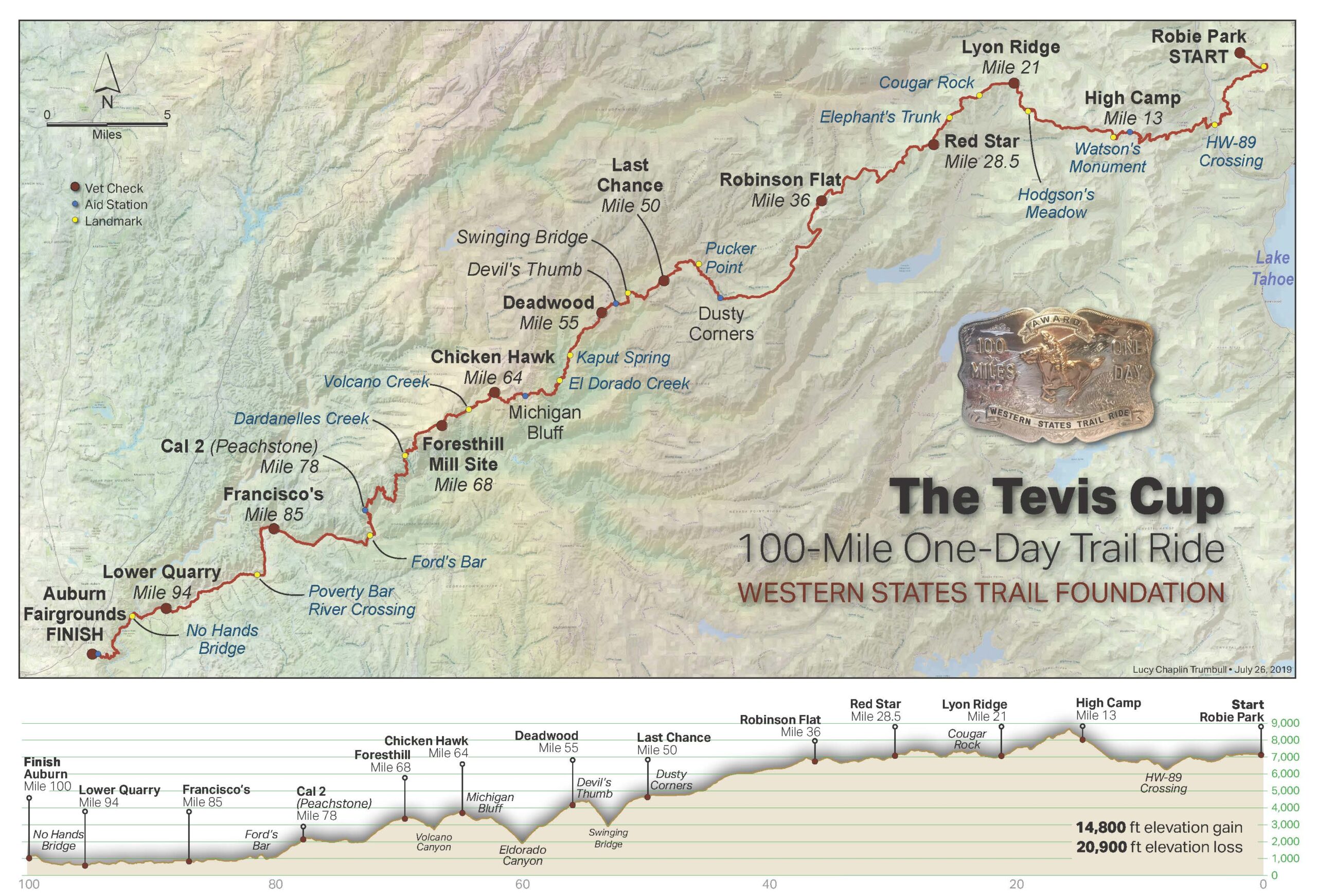
Trail Maps
Interactive Google Map of the trail (click in the top right corner to enlarge):
For some light relief, a trail flyover, complete with cartoons from endurance.net, celebrating the 2010 ride. The trail has changed a little since then, but this definitely captures some of the extreme terrain riders traverse during the ride.
(Note: the trail varies slightly from year to year, depending on conditions, accessibility, and other factors)
(This file will need to be loaded into a GPS app or unit)
(This file will need to be loaded into Google Earth or Google Maps to view)