“Tevis cometh…be ye ready?”
The Ride Director Speaks…
The 68th Annual Tevis Cup will start at Robie Park. The parking is going to ample. We can fit you in with whatever size rig you bring to the start. We ask that you do not arrive prior to Thursday morning, July 18, as our volunteers will arrive onsite starting Thursday about noon. If you arrive earlier than noon on Thursday, you must park on the left side (west side) of Road 6.
Vendors and Ride Management will be available on Friday. Lunch (noon to 3 pm) and dinner service (4:30-6 pm) will be available for purchase in the Meadow.
Rider check-in will start at 11 am on Friday July 19th at Robie Park.
Horse check-in will start at 1 pm and end at 5 pm. Watch for the cameras. The famous Tevis photographers and our LiveFeed team will be filming the check-in.
* * *
The start of the ride at the break of dawn heads south on Road 6 and will be a controlled start for the first mile until the gravel road turns to a dirt road. This is the official “timed start” line, and all riders will be held there until 5:15 am when the trail will officially open. Riders will have their number recorded by the timers and must pass that line by 5:30 am (at the latest) to be officially started in the 68th Annual Tevis Ride.
Riders will cross under Highway 89 on their way to Palisades ski resort. From there they will continue up to High Camp, Watson Monument, through Granite Chief Wilderness and over to the Lyon Ridge trot-by. It is exciting to be back on the traditional trail! Cougar Rock comes up next!
After Red Star, riders will travel down the road to Robinson Flat. Be sure you know your cut off times on the checkpoint card. You will travel into Robinson Flat for the first one-hour vet check. From Robinson Flat we head over to the Pucker Point trail—yep! we’re back! – so pucker up and enjoy the views.
Hours and hours of time and energy have gone into seeing that this Tevis Ride is as special and memorable as any past ride. We look forward to seeing you at Robie Park.
Your rider packets have been sent by email to you and are also posted online at teviscup.org. Rule books, passes, and checkpoint cards were mailed out on July 8 to riders with addresses in CA, OR, WA, NV and ID. All other riders can pick up their materials in the Tevis office at 150 Gum Lane, Suite C, in Auburn the week in advance of the ride.
Keep training! We will be ready for you on July 20th!
Chuck Stalley
2024 Tevis Ride Director
AND the 20-member Tevis Ride Committee
Ride Day Links!
Fans and crew and volunteers – there are a myriad number of ways to ‘watch’ the entire ride and keep up with your rider or just watch the dramatic event unfold.
Click here to go a page which features links to all the fun:
- WEBCAST – track your rider from vet check to vet check, see how they are faring in the field
- SPOT TRACKER – all riders will wear GPS trackers and here you can see a live map of the trail with everyone’s location or look at an individual rider
- FACEBOOK – the Tevis Facebook page will host photography and live feed videos from the course and is the center for spectator commentary and getting questions answered as the ride unfolds
- YOUTUBE – will host a live feed video from Red Star Ridge (first major vet stop) starting at 7:00 AM
- FLICKR – photos from our host of roaming volunteer photographers will be uploaded as signal permits during the ride
Food!

There will be food available at Foresthill (Bella Familia Pizza) and at the timed finish at the Auburn Overlook (Los Establos Mexican Food from 9 PM to 5 AM) on ride day.
Trail Report
Amazing Volunteer Effort – WS Trails Teams are working actively up until ride day to ensure a clear trail. We think you will really enjoy the trail work completed this year and the Trails Team wishes everyone a great ride 7/20! We hope more equestrians join the trail workdays in the future. Thank you, Trails Team volunteers!
“Miller’s Defeat” Trail Addition
Whilst the basic “Tevis Cup Trail ” concept has remained essentially the same since its inception in 1955 — riders travel from “Lake Tahoe to Auburn” — the actual route itself has changed in small increments over the years. Development, trail deterioration, land ownership, and management issues have all contributed to the route we ride today.
For this year, we have decided to detour off the usual hot, hard-packed gravel Road 43 (the road that leaves Robinsons Flat on the way to the turn off for Dusty Corners) and pick up the trail that the runners use during our sister event, the Western States Endurance Run.
This trail, known as Miller’s Defeat, starts approximately 2.5 miles after you leave Robinsons Flat and parallels Road 43, gradually winding off the ridge before ending a really fun stretch of twisty, soft-footing singletrack trail in the shade of the forest. To the east, you’ll catch glimpses of the views overlooking French Meadows Reservoir, Duncan Canyon, and Granite Chief Wilderness beyond.
We hope you’ll enjoy what we believe to be a preferable trail option to the endless Road 43 – afterall, it is the Western States Trail Ride.
Short videos of what the trail has to offer can be found here.
GPS Tracks
This year we hope to have the GPS ride route available as a GPX download, in Gaiagps.com, as well as a Rides With GPS option. Since the specific routing of the trail is still being fine-tuned, the track will not be available until Ride Week, but will be posted on social media as soon as it’s ready.
Of course, last minute changes can and do happen, so following the ribbons on the day is the “go to” option but we hope having the track available will help out our directionally-challenged friends and put their minds at rest.
(Note we hope that the Rides With GPS track will have voice cues, but these may be limited to the night-time portions, as well as any specific trail hazards. More to come at https://www.facebook.com/groups/tevistrailtothetrail).
Ed Ride Grads Take on the Ride!
Tevis Educational Ride graduates starting Tevis this year:
The members of the Tevis Educational Ride Planning Group wish the 2024 Tevis Ed Ride Graduates the best of luck for a safe and successful Tevis Ride. You’ve done your homework and have pre ridden the toughest 50 miles of the trail with our A-list Mentor Team as your guides. You’ve Got This!! Knowledge + Experience = Tevis Success!
- Shelby Craythorn (Delaney)
- Susannah Jones
- Belle Stroh
- Erna Valdivia, Junior Rider!
- Jennifer Gomez
- Scott Stewart
- Jeanlaurie Ainsworth
- Addison Lico, Junior Rider!
- Terry Zygalinski
- Ida Schroeder
Shout out to the Lens Legends!
- Lynne Glazer* will be at High Camp and Foresthill.
- Dominique Cognee* will be at Red Star and Michigan Bluff.
- Merri Melde* will be at Robinson Flat.
- David Lewis will be at Elephants Trunk.
- Alicia Berardi will be at Swinging Bridge.
- Bill Gore* will be at Cougar Rock and the finish line.
* Will also be at Robie Park on Friday.
Shopping!
Here is a list of the vendors you’ll find at Robie Park and/or at the Gold Country Fairgrounds;
- Hought Tack [www.Hought.com] – Biothane Tack and Horse Art
- Qi Horse Equine Care [www.qihorseequinecare.com] – Pre-race Equine Sports Massage ( Available 7/16-7/18)
- @heckabeckdesigns – Beautiful “Crew” gift packages for a nice “Thank You”
- Kloud [centropix.us] – PEMF Therapy for horses and more
- Auburn Total Health [auburntotalhealth.com] – Colon Hydrotherapy, Hyperbaric Oxygen Therapy, Far Infrared Sauna, PEMF, and Thermography – great for pre-ride out after ‘Self” recovery
- Get Back in Motion (getbackinmotion.net] – CBD tinctures and mists for humans – cookies, topical oils and pain reliving sprays
- Equithotics [Equithotics.com] – Sneakers for Horses
- Endurance Capital of the World [https://auburnendurancecapital.org/] – All Trails Lead to Auburn
- An Equine Addiction [anequineaddiction.com] – Experienced Equine Product Professionals
- Performex [Performex.us] – Ergogenics for Equestrian Athletes
- Cool Country Chic Swag
Trail History – Want to learn more?
The Western States Trail is paved with rich history. A few illustrious members of the Ride and Run communities have collaborated to write several books which capture the highlights. Here are a few excerpts to whet your appetite:
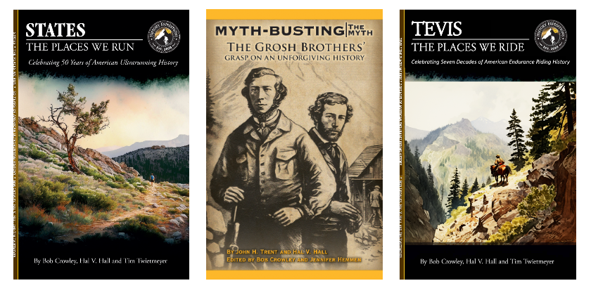
From “The Places We Run” by Bob Crowley, Hal V. Hall, and Tim Twietmeyer:
https://historyexp.org/states-the-places-we-run-ebook/
Robinsons Flat – 36 Miles
Next place: Miller’s Defeat 40.1
Miles to Auburn: 64
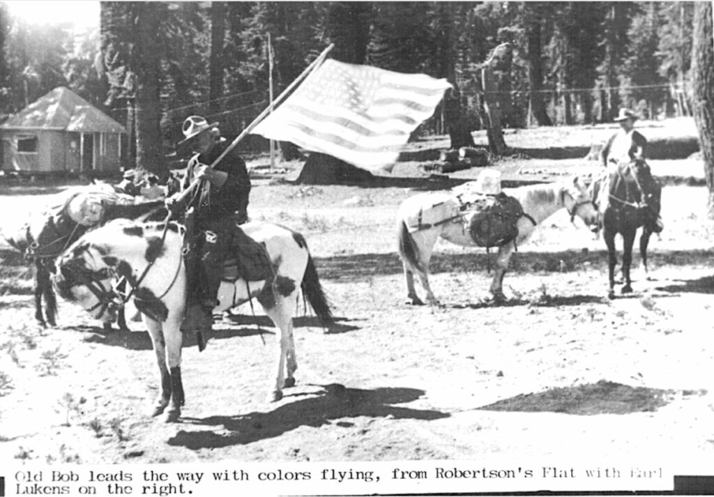
Robert Montgomery Watson at Robinsons Flat, 1931. (Photo by Wendell Robie, Hal V. Hall Collection)
Since 1852 this was the summer cow camp of Captain M.M. Robinson who was from the gold rush mining town of Wisconsin Hill. The Robinsons played an important role in the development of the Foresthill (Placer County Emigrant) Road, as the ranch was a popular stop for travelers.
Originally named Robertson Flat (also Roberts Flat), the name was officially changed to Robinsons Flat on June 8, 1961, by the U.S. Geological Survey, with credit to Wendell Robie. Robinsons Flat’s grassy meadow has a pitcher pump near a large granite stone inscribed, “Crossroads of the Sierra.”
Robinsons Flat may have been first visited by emigrants in 1844 when six members left the Stephens-Townsend-Murphy Party to find an easier pass and quicker route while the others followed the directions of Chief Truckee over the Sierra crest.
Duncan Peak/Little Bald Mountain (Pass by)
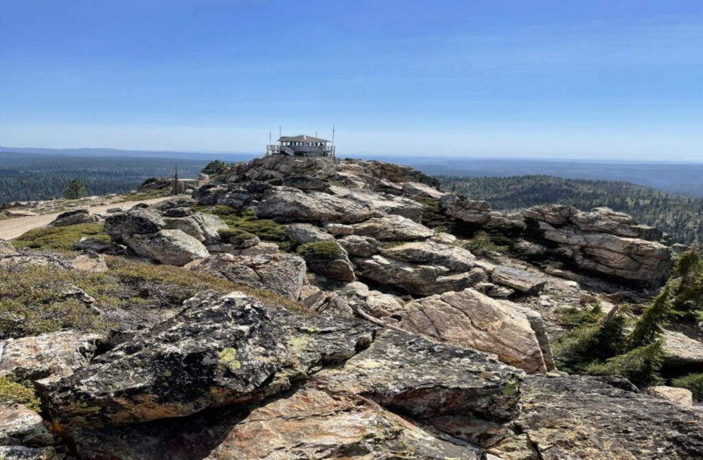
Duncan Peak was named for Thomas Duncan, an 1848 gold miner from Missouri who entered this area via the Emigrant Trail from Little American Valley. The region was first mined in the early 1850’s. Whether on USFS Road 43 or the trail to Bald Mountain, riders pass by Duncan Peak, which is less than a mile to the west of Robinsons Flat. Within a mile, atop a high cone-like mass of white granite of Bald Mountain is the Duncan Peak Lookout Tower, which has vistas of California from the high crest of the Sierra in the east, to the Coast Range to the west, and from the far north of the Sacramento Valley to the San Joaquin Valley in the far south. This is one of the last remaining lookouts in California. From this vantage point, one can look northeast and see Emigrant Pass near Squaw Peak and southwest to see the canyons of the Western States Trail. It’s pretty darn awesome.
Miller’s Defeat/USFS Road 43 Intersection – 40.1 Miles
Next place: Dusty Corners 44.5
Miles to Auburn: 59.9
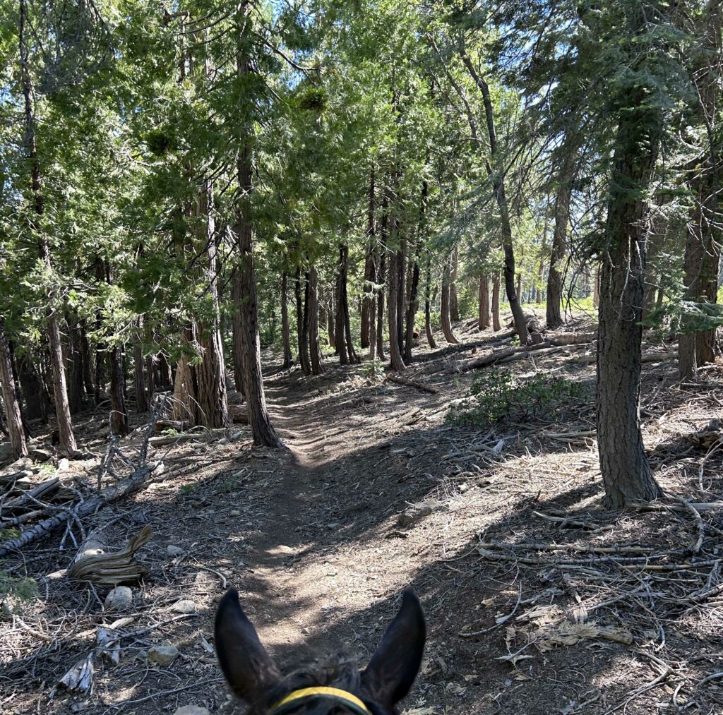
According to local legend, two miners, Sperry and Brown, who averaged $6.00 to $8.00 a day in wages for a year, met a third miner named Miller, who tried to obtain a larger claim than entitled. Claims were limited to the length of a pickaxe handle (3 feet) held to each side of one’s body which would be about 8 feet. When it came time for Miller to measure off his claim, he substituted a young pine sapling for his regular pickaxe handle. When the other miners refused to accept this substitution, Miller was defeated, hence the name. This account was told by John Robinson, president of the Placer County Historical Society in 1961. In another account, Gene Markley told the story that an Irish rich placer digging was taken over by a group of Italians in hand-to-hand fighting.
In 1854, Miller’s Defeat was a right-of-way claim for the construction of a ditch to the Cosmopolite Mining District. It was near here that E. Allen Grosh and R.M. Bucke was found struggling on their hands and knees by miners in early December 1857 having crossed the Sierra Nevada during a battering of winter storms but had become lost, frost bitten, starved, and hypothermic. Bucke survived the ordeal but had both of his feet amputated. Grosh perished and is buried at Last Chance.
Dusty Corners/Deep Canyon – 44.5 Miles
Next place: Pucker Point 46.5
Miles to Auburn: 55.5
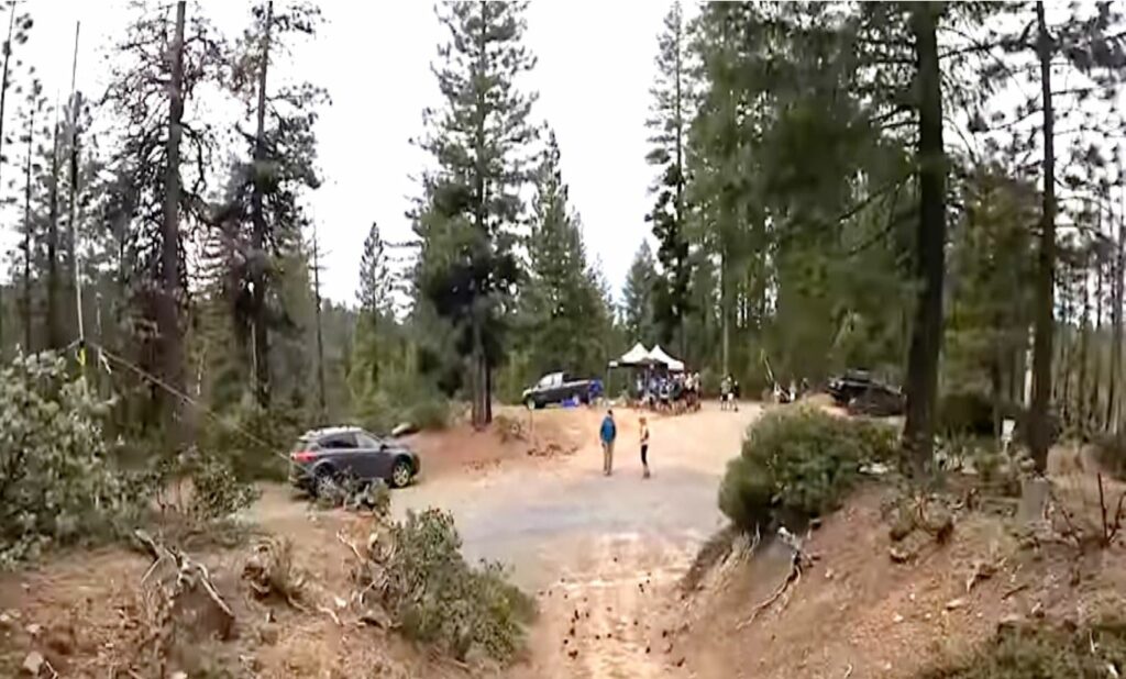
The origin of the name “Dusty Corners” is a mix of myth and fact. Purportedly, the name came from the early days of logging where trucks would grind up the dirt into fine particles with their heavy loads at this key wilderness intersection of logging roads. Due to the conditions, clouds of dust were kicked up by any passerby on foot or horse. The location is also at the crossroads of original mining roads.
Deep Canyon was the location of several mines located on the upstream section of the channel worked in the Glenn Mine between Duncan Canyon and Deep Canyon. The ground produced coarse gold like what was found at the Glenn Mine. The old mining camp of Miller’s Defeat was situated on or near Deep Canyon which was occasionally referred to as Miller’s Defeat Canyon.
The Dusty Corner check point has provided riders and their horses with a welcome but brief respite before they head off into the famous hot and rugged canyons of the Western States Trail.
If you enjoyed those excerpts, you can download (for free) the ebook versions by clicking here.