• Skip to primary navigation
  • Skip to main content

The Tevis Cup

100 Miles - 1 Day - Trail Ride

  • THE RIDE
    • Ride Day Links
    • 2025 Ride
      • Entering The Ride
      • Preliminary Entrant List
    • Planning for the Ride
      • Ride Dates
      • Rider Resources
      • Vet Check Maps
      • Checkpoint Locations and History
    • Crews and Spectators
      • Where to Watch?
      • Crew Guide
      • Checkpoint Locations and History
    • Volunteering
    • Historical
      • RESULTS (1955-present)
      • Buckle Recipients
      • Past Cup Winners
      • Facts and Figures
      • Tevis Forums
      • Videos
    • Tevis Photographers
    • Flickr Photos
    • Tevis Facebook
    • Tevis YouTube Channel
    • Sponsors
    • Rules & Policies
  • THE TRAIL
    • The Trail
    • Checkpoint Locations and History
    • Videos of the Tevis Ride and the Western States Trail
    • Tevis Trail FAQ
    • Vet Check Maps
    • Pre-Riding the Tevis Trail
    • Trailwork Days Sign Up
    • How to Help with Trail Maintenance
    • Granite Chief Wilderness – Trail Reroute
  • EDUCATION AND TRAINING
    • Virtual Tevis Cup 2025
    • Trail to the Trail
    • Tevis Training Ride Weekend
      • Tevis Training Ride 2025 Entry
      • Tevis Training Ride 2025 – Entrants
    • Educational Videos
    • You Can Do It!
    • Sweat – and How to Save It
  • WSTF
    • WSTF Board
    • Dru Barner Award
    • Annual Reports
    • Equine Welfare Studies
    • Tevis Forums
    • Where Does All the Money Go?
    • Rules & Policies
    • Copyright Information
    • Contact Us
  • DONATE
  • TEVIS STORE
  • PAST POSTS
  • Show Search
Hide Search

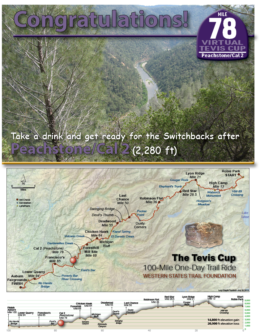
Peachstone/Cal-2

Take a drink and get ready for the Switchbacks after Peachstone/Cal 2   (2,280 ft)
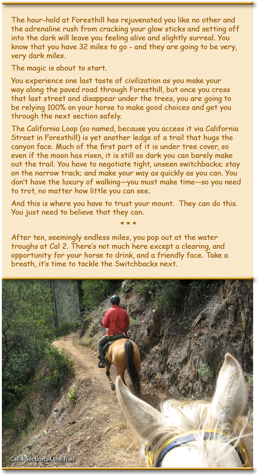
The hour-hold at Foresthill has rejuvenated you like no other and the adrenaline rush from cracking your glow sticks and setting off into the dark will leave you feeling alive and slightly surreal. You know that you have 32 miles to go - and they are going to be very, very dark miles.  The magic is about to start. You experience one last taste of civilization as you make your way along the paved road through Foresthill, but once you cross that last street and disappear under the trees, you are going to be relying 100% on your horse to make good choices and get you through the next section safely.  The California Loop (so named, because you access it via California Street in Foresthill) is yet another ledge of a trail that hugs the canyon face. Much of the first part of it is under tree cover, so even if the moon has risen, it is still so dark you can barely make out the trail. You have to negotiate tight, unseen switchbacks; stay on the narrow track; and make your way as quickly as you can. You don’t have the luxury of walking—you must make time—so you need to trot, no matter how little you can see.  And this is where you have to trust your mount.  They can do this. You just need to believe that they can.  * * * After ten, seemingly endless miles, you pop out at the water troughs at Cal 2. There’s not much here except a clearing, and opportunity for your horse to drink, and a friendly face. Take a breath, it’s time to tackle the Switchbacks next.

On June 19th to 24th 2016, the American Trail Running Association partnered with the Google Maps team to capture 360 degree panoramic “street-view” imagery of the entire Western States Trail using the Street View Trekker backpack:
Cal 2/Peachstone

TEVIS QUICK LINKS

The Ride
The Ride
Ride Entry
Rider Resources
The Trail
WST Map
Volunteering
Trail Work Sign Up
Education & Training
Educational Events 2025
Virtual Tevis Cup
Bits and Bobs
Archives
Sponsors
Vendor Registration
Contact Us
WSTF@teviscup.org
(530) 823-7282

The Tevis Cup

Copyright © 2025 · Log in