• Skip to primary navigation
  • Skip to main content

The Tevis Cup

100 Miles - 1 Day - Trail Ride

  • THE RIDE
    • Ride Day Links
    • 2025 Ride
      • Entering The Ride
      • Preliminary Entrant List
    • Planning for the Ride
      • Ride Dates
      • Rider Resources
      • Vet Check Maps
      • Checkpoint Locations and History
    • Crews and Spectators
      • Where to Watch?
      • Crew Guide
      • Checkpoint Locations and History
    • Volunteering
    • Historical
      • RESULTS (1955-present)
      • Buckle Recipients
      • Past Cup Winners
      • Facts and Figures
      • Tevis Forums
      • Videos
    • Tevis Photographers
    • Flickr Photos
    • Tevis Facebook
    • Tevis YouTube Channel
    • Sponsors
    • Rules & Policies
  • THE TRAIL
    • The Trail
    • Checkpoint Locations and History
    • Videos of the Tevis Ride and the Western States Trail
    • Tevis Trail FAQ
    • Vet Check Maps
    • Pre-Riding the Tevis Trail
    • Trailwork Days Sign Up
    • How to Help with Trail Maintenance
    • Granite Chief Wilderness – Trail Reroute
  • EDUCATION AND TRAINING
    • Virtual Tevis Cup 2025
    • Trail to the Trail
    • Tevis Training Ride Weekend
      • Tevis Training Ride 2025 Entry
      • Tevis Training Ride 2025 – Entrants
    • Educational Videos
    • You Can Do It!
    • Sweat – and How to Save It
  • WSTF
    • WSTF Board
    • Dru Barner Award
    • Annual Reports
    • Equine Welfare Studies
    • Tevis Forums
    • Where Does All the Money Go?
    • Rules & Policies
    • Copyright Information
    • Contact Us
  • DONATE
  • TEVIS STORE
  • PAST POSTS
  • Show Search
Hide Search

Lyon Ridge

Congratulations - You have reached the trot-by at Lyon Ridge (7,000 ft). You have just traversed the Granite Chief Wilderness overlooking the Picayune Valley, winding your way around granite boulders, twisting between the trees, clambering up short steep slopes in dark fluffy soil, and ducking through the thick green foliage along the creeks that feed the headwaters of the Middle Fork of the American River.
The trail through Granite Chief Wilderness is the jewel of the Tevis trail. Because it’s difficult to access, it is seldom pre-ridden and serves as a delightful gift to riders. You are completely removed from civilization as you make your way through the soft loamy forest where you can barely hear hoofbeats.  There is an under-saddle trot-by at Lyon Ridge where a vet will check your horse’s gait and send you on your way if no problems are detected. Many people take advantage of the water troughs to electrolyte their horses here - there is no further water source along the rocky volcanic ridgetop until you reach Red Star Ridge 7 miles down the trail.

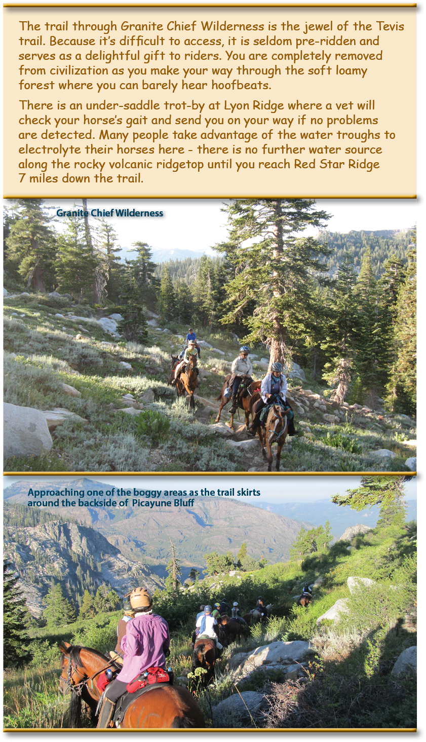
History of Granite Chief Wilderness:

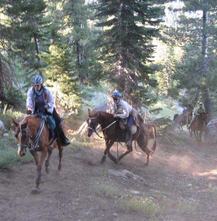
The Granite Chief Wilderness was designated a Wilderness area in 1984 because of its pristine nature, natural beauty, and primitive, non-motorized recreational opportunities. Located on the west shore of beautiful Lake Tahoe, the Granite Chief Wilderness is managed by the Tahoe National Forest. This 25,680 acre wilderness offers beautiful valley meadows and spectacular 9000 foot granite peaks. It encompasses the headwaters of the Middle Fork of the American River. Another visual splendor is Picayune Valley, the glacial trough separating Mildred Ridge from Squaw Peak. The trail cuts over the shoulder of Picayune Bluff and works its way from bench to bench up the high ridge under talus slopes below Needle and Lyon Peaks. It is at this point that the trail leaves the Granite Chief Wilderness.

The U.S. Forest Service – American River Ranger District (USFS) has secured $800,000 in funding for the Granite Chief Wilderness Trail Reroute project through the Great American Outdoors Act (GAOA). The USFS, the Western States Endurance Run Foundation (organizers of the WSER), and the Western States Trail Foundation (organizers of the Tevis Cup Ride), worked together over several years to develop and gain approval of a plan for non-motorized alternative trail access through Granite Chief Wilderness.

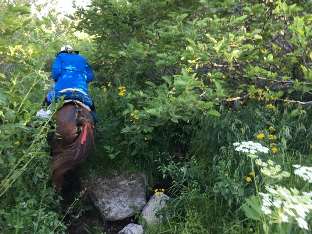
The new reroute will avoid some of the twisty, steep in places (up to 30%) grades, eroded to deep dust or conversely sub-alpine riparian terrain – aka the bogs – by moving the trail 200-300 feet upslope to 8,200 ft, away from dense vegetation and the springs that feed these boggy areas, resulting in more than 5 miles of new trail along the ridge connecting Granite Chief, Needle and Lyon Peaks. The new trail will access alpine terrain that has not previously been accessible, which will afford stunning views to the south, east, and west. Unsustainable sections of the existing trail will be closed and vegetation in the affected area restored.

Steep dusty terrain
Rider crossing through one of the bog areas

On June 19th to 24th 2016, the American Trail Running Association partnered with the Google Maps team to capture 360 degree panoramic “street-view” imagery of the entire Western States Trail using the Street View Trekker backpack:
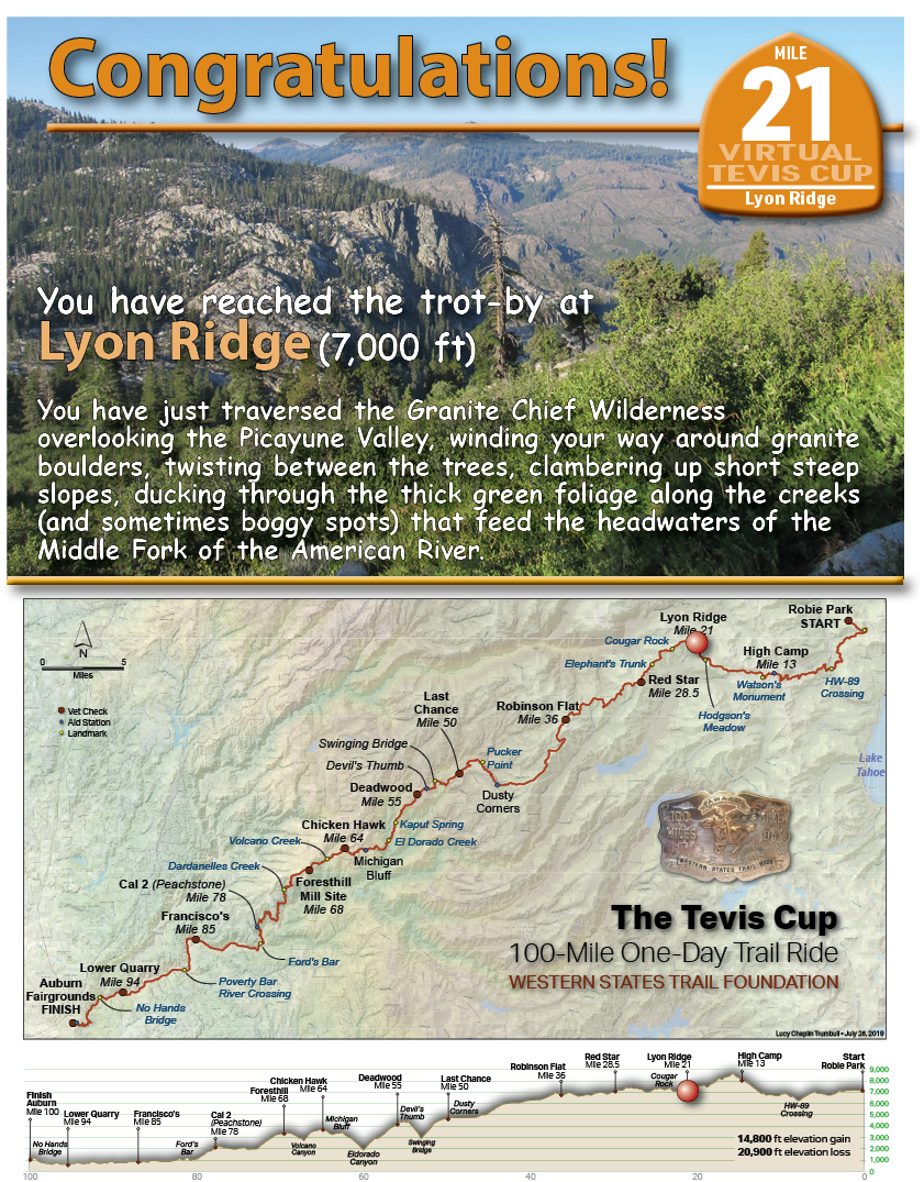
Lyon Ridge

TEVIS QUICK LINKS

The Ride
The Ride
Ride Entry
Rider Resources
The Trail
WST Map
Volunteering
Trail Work Sign Up
Education & Training
Educational Events 2025
Virtual Tevis Cup
Bits and Bobs
Archives
Sponsors
Vendor Registration
Contact Us
WSTF@teviscup.org
(530) 823-7282

The Tevis Cup

Copyright © 2025 · Log in