History of Olympic Valley:
Olympic Valley (formerly Squaw Valley) is one of several narrow notched mountain valleys found in the eastern mountain portion of Placer County that was best known in 1862 for summer pasturage for horned cattle, and for dairying purposes. The herbage here was sweet and did not cause distasteful flavor to dairy products, while the cold, pure water insured cleanliness and solidity to the article. Nearly all of these mountain valleys were occupied for this business, and a great deal of butter was made, which, as a rule, had a ready market without leaving the mountains at tourist resorts and the logging and wood-chopping camps and mills.
Two prospectors in June 1863 made their way from Yankee Jim’s, near Foresthill, over the Squaw Valley summit pass into this beautiful mountain meadow. John Keiser and Shannon Knox were vaguely headed in the direction of Carson City when, near the Truckee River just northwest of the mouth of Squaw Creek, they located outcroppings of rich-looking reddish ore. It was rock similar to that in which the Comstock silver lode had been found. A mile up river additional findings were discovered.
The news spread as tales of wealth touched off a rush from the mother lode to the newly discovered area over the short-cut route from the western slopes of the Sierra. Men came scrambling from the Northern California mining towns of Placerville, Georgetown, Last Chance, Kentucky Flat, Michigan Bluff, Hayden Hill, Dutch Flat, Baker Divide, Yankee Jim’s, Mayflower, Paradise, Yuba, Deadwood, Jackass Gulch and all the other camps whose locators and residents had not been as fortunate financially as they were linguistically. These wilderness areas had been transformed into bustling, thriving settlements of miners, merchants, mechanics, gamblers, saloon keepers and bummers, otherwise known as “gentlemen at large.” Nearly six hundred frenzied miners searching for fortune traveled the short cut to arrive at their new destination of hope.
At the site of the first “strike,” the settlement of Knoxville, named for Shannon Knox, boomed. Then Claraville rose up overnight upriver, near the location of the second discovery site. Both locations were pieced together with rough shacks, dirt floor hotels, unorganized main streets, and few having the common necessities. Town lots that had sold a few weeks before for $10 all of sudden were selling for up to $200.
With all of this haste came some bad news. The ore samples had failed to prove out. Some had claimed that the samples were “salted” with ore brought from Virginia City. Yet some of the old timers assert that Knox was “square” and that he firmly believed he had paying ore. So, like an explosion in reverse, a rush in the other direction began. The excitement was gone nearly as fast as it came. In almost six months, the settlements of Knoxville and Claraville which numbered several thousand went from boom to bust as the streets, shacks and mines were deserted. By the beginning of 1864 the camps were all but dead.
Meanwhile, the Prescott brothers had improved the trail from Squaw Valley to Foresthill over the western summit. By April 1864, it was considered “a usable thoroughfare.” Lots in Knoxville and Claraville were purchased at bargain prices by the Prescotts, who hoped to build a permanent settlement with farming and lumbering. And so, for the half century that followed, Squaw Valley settled in as a quiet, high Sierra farming district, a secluded summer range for running cattle.
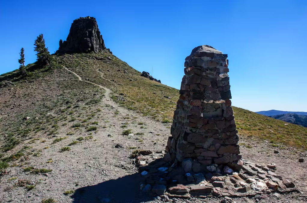
“The Trail Blazer” Robert Montgomery Watson
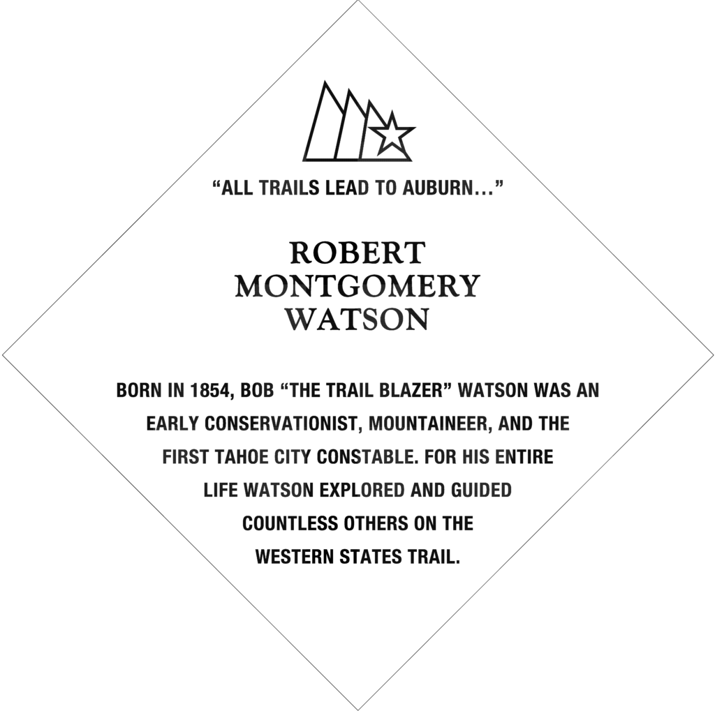
Robert Montgomery Watson arrived at Lake Tahoe in the 1870s and was appointed Tahoe City’s first constable in 1906. Constable Watson served his community until 1932 when he died of pneumonia at the age of 80.
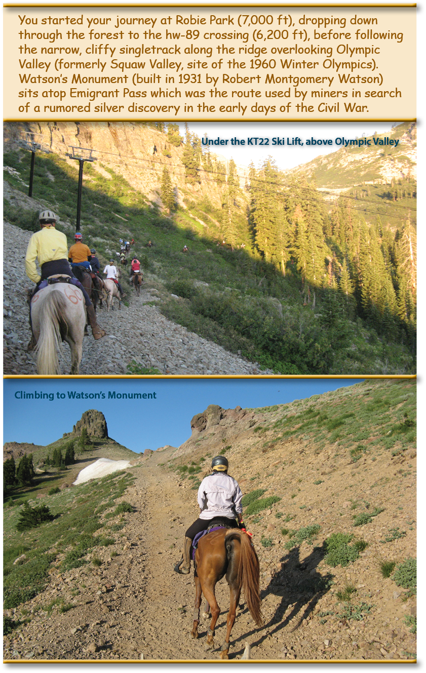
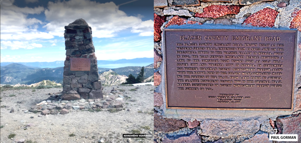
Robert Watson was a noted horseman and trail explorer who used these skills to help explore, re-open and mark what was then known as the old Placer County Emigrant Road over Squaw Valley, and is today known as the Western States Trail and site of the Tevis Cup 100 Miles in One Day Endurance Ride and the Western States 100-Mile Endurance Run. In the summer of 1931, the Auburn Parlor 59 of the Native Sons of the Golden West organized a trail party to locate and officially mark with signage the entire historic Auburn to Lake Tahoe trail. The group completed their task in September of that year. The trail party was led by Robert Watson and included Dr. Conrad Briner (former Mayor of Auburn), Wendell Robie (founder of the Tevis Cup Ride), Earl Lukens, William Patrick and Lavelle “Jack” Shields.
Footage of that original journey was created by Keith Lukens and preserved by his son Reed Lukens for the Western States Trail Museum
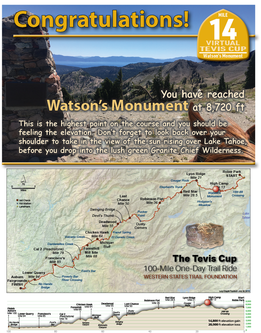
Watson’s Monument was originally constructed by Robert Watson during that summer of 1931. It was officially commemorated to his efforts in 1998. It is located just below the top of Squaw Peak near Olympic Valley, CA with sweeping 360 degree vistas all around.
This one is DEFINITELY worth the click. We recommend using the > arrow which will appear on the screen to move forward and back along the trail and scroll around to appreciate the view from all sides, both looking back at Lake Tahoe and forward to Auburn. This is a very emotional moment for many riders during the ride.
On June 19th to 24th 2016, the American Trail Running Association partnered with the Google Maps team to capture 360 degree panoramic “street-view” imagery of the entire Western States Trail using the Street View Trekker backpack:
Watson’s Monument