The Trail
Trail Sections & Historic Notes
from The Western States Trail Guide
Historical Notes by Hal V. Hall
© WESTERN STATES TRAIL FOUNDATION, All Rights Reserved
(Note: the trail varies slightly from year to year, depending on conditions, accessibility, and other factors)
(This file will need to be loaded into a GPS app or unit)
(This file will need to be loaded into Google Earth or Google Maps to view)
Click on the individual points for more information about each location:
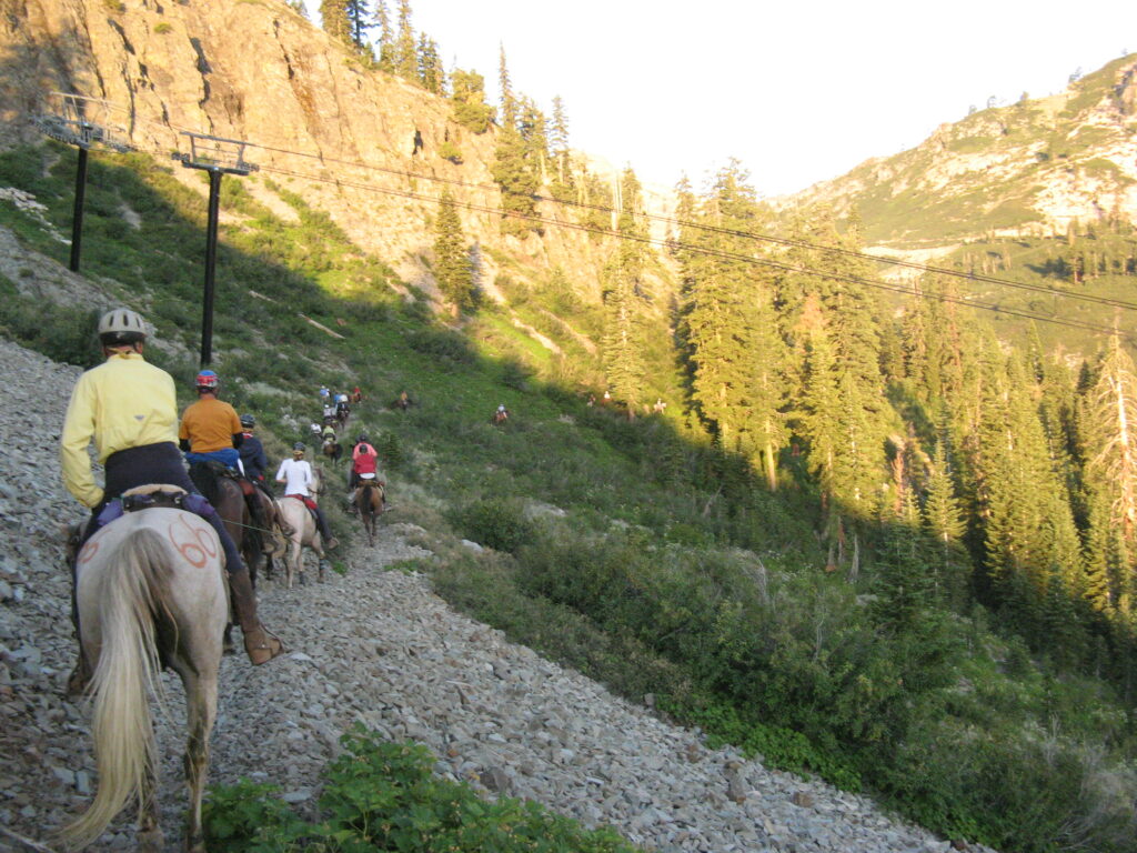
Robie Park to Olympic Valley (Formerly Squaw Valley)
Tevis riders connect to the Western States Trail after a short distance along a graded dirt road, starting at the Robie Equestrian Park (elevation 7,000 feet), six miles south of Truckee, California, and a few miles due east of Olympic Valley. By heading west, riders and hikers descend gradually approximately five miles to the Truckee River at the Midway Crossing on Highway 89.
Beginning in 1999, the route after the Truckee River crossing follows a riding and hiking trail along the South slope of Olympic Valley. The trail re-connects with the historic route about a mile short of Watson’s Monument, avoiding the now-paved sections of the original route across the floor of Olympic Valley.
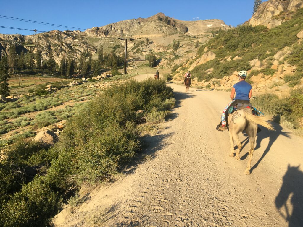
Olympic Valley to Robinson Flat
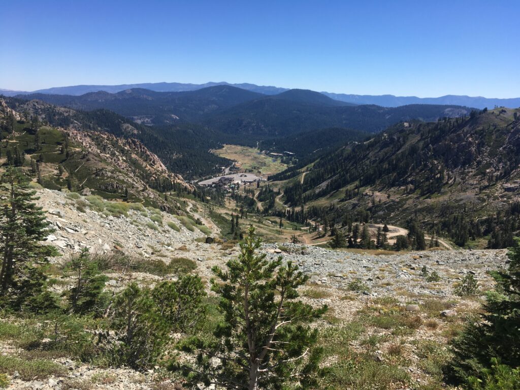
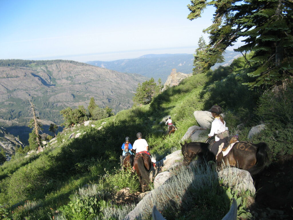
The Tevis Cup trail ascends from the Truckee River (elevation 6,200 feet) through the Palisades-Tahoe ski resort area to Emigrant Pass (elevation 8,774 feet), a climb of 2,550 vertical feet. Historic accounts reveal that the ascent from the Olympic Valley (formerly Squaw Valley) floor for emigrants and miners whether by horse or wagon was steep and difficult as the footing was troublesome over loose rubble and around boulders.
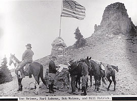
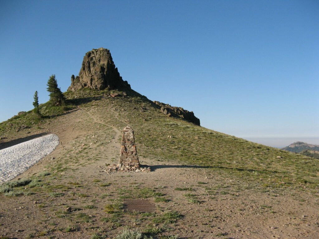
Atop the summit at Emigrant Pass a rock monument stands, built by Bob Watson in 1931, at an elevation of 8,774 feet, appropriately named Watson’s Monument. The blocky volcanic outcropping nearby on the southern crest was named Fort Sumter in the early days of the Civil War, when California miners passed over the summit from the west upon rumor of a silver discovery known as the Squaw Valley Excitement.
To the south of Emigrant Pass is Squaw Peak and to the north is Granite Chief. To the east, an unforgettable scene of grandeur and color meets the eye with peerless Lake Tahoe in a sapphire setting among snow-covered peaks and rugged mountains.
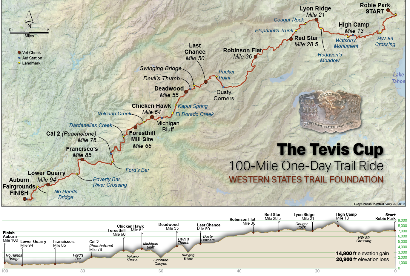
Approximately one mile prior to (and 500 feet below) Watson’s Monument at Emigrant Pass, riders pass through a water stop / number taking station at “High Camp“. A vet is available at this location if any difficulties are encountered.
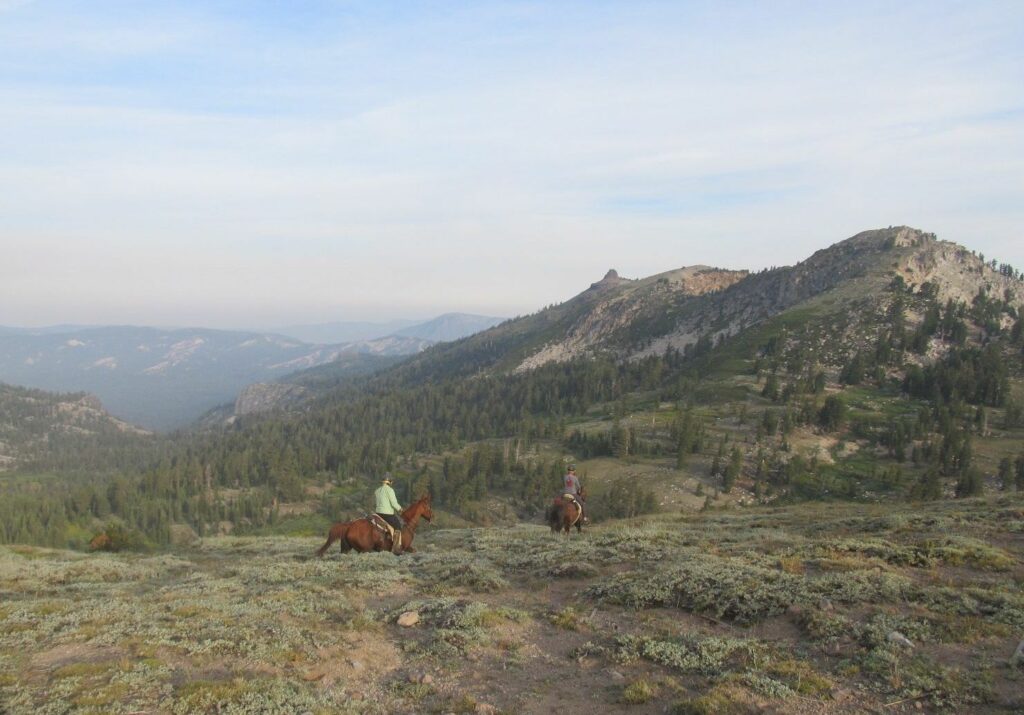
From Watson’s Monument to Robinson Flat the trail, for the most part, follows the historic route of the Placer County Emigrant Road built in 1855.
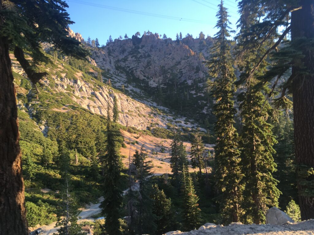
From the pass, you may choose to travel a southwesterly direction, descending to Little American Valley which lies at the extreme head of the Middle Fork of the American River, at an elevation of over 7,400 feet. It is a beautiful valley with a wild stream that is seemingly guarded by the highest mountain peaks in this region.
During times of late spring, snowfall or lack of thaw, the trail through the little valley is sometimes impassable.
Early day sheepherders and pack strings found an alternate route, now used by the Tevis Cup Ride, to the north of the valley on the sunny south slope of Granite Chief and Needle Peak. Trail conditions dictate which trail to travel upon.
Part-way down from the pass, the trail enters the Granite Chief Wilderness Area set aside by the United States Congress in 1984 as apart of the California Wilderness Act. Granite Chief was established to protect the wildlife environment including deer, bear, pileated woodpecker, blue grouse, marten, goshawk, and rainbow and brown trout and encompasses some 15,000 acres to the south of the trail. The wilderness designation ended several decades of controversy between preservation and commodity user groups.
To the west, beyond the cut banks and channels of streams and springs that develop around the slopes of the little valley, the trail cuts over the shoulder of Picayune Bluff with a breathtaking view from the rim rock. This pioneer landmark whose name means “small bluff,” was what every early-day traveler looked for as a guide over the trail. From this vantage point through cathedral-like rock formations there is a beautiful view of pristine Picayune Valley and Mt. Mildred to the south.
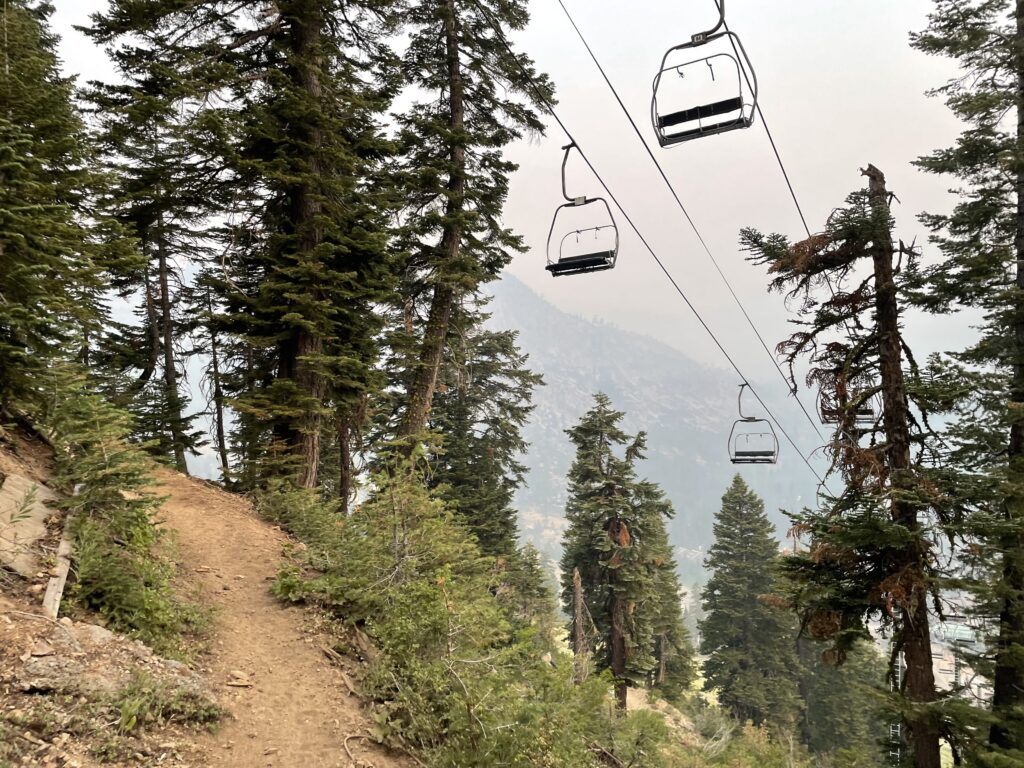
The trail works its way from bench to bench up the high ridge under talus slopes below Needle and Lyon Peaks.
Over the ridge the trail passes near the old logging campsite of Hodgson’s Cabin (cabin no longer there), built in 1946. Shortly after this point the trail leaves the Granite Chief Wilderness and eventually emerges on the very spine of the high divide separating the high country watersheds of the North and Middle Forks of the American River at Soda Springs Pass (sometimes referred to as Wubbena Pass), with a great view north and south of a hundred miles of Sierra Nevada mountain peaks. Ahead, a break in the western ridge provides a view of the deep and mighty Royal Gorge, under the high ramparts of Snow Mountain that marks yet another pioneer landmark of the trail.
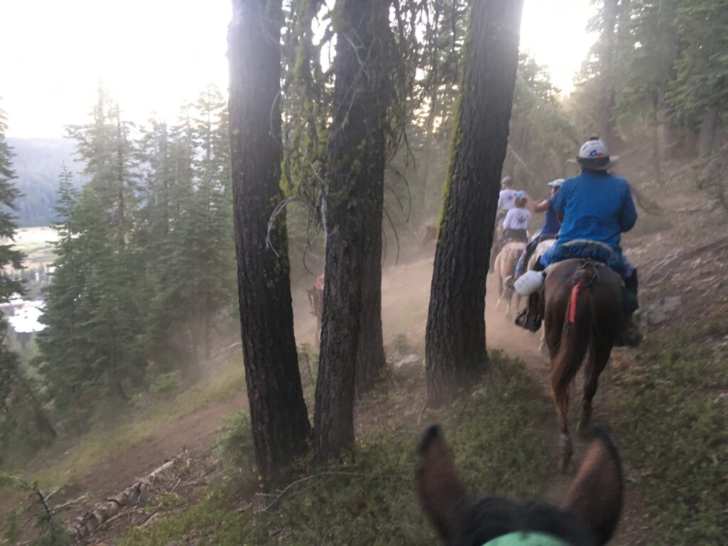
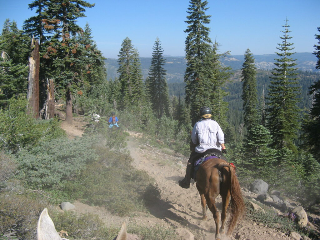
The trail holds its course for several miles along the very summit of the Foresthill Divide. The ridge is narrow, which displays sweeping views of great canyon depths on either side below. Looking back to the southeast one can find the small and lovely glaciered Picayune Valley that runs to the northeast of the reddish colored shale canyon wall of Mildred Ridge, with a trail of its own up through the middle along Picayune Creek that follows beside several cascades and waterfalls. This divide also serves as the northern boundary of a state wildlife refuge. Along this narrow volcanic ridge the trail repeatedly climbs and descends through forest and rock.
Riders will encounter a trot-by at Lyon Ridge (where you are first able to look down into Royal Gorge).
Since its inclusion into the Granite Chief Wilderness, the vicinity around Hodgson’s Meadow has been rehabilitated, the dirt roads removed and replaced with switchbacked trail.
the shortest equine to ever complete Tevis (2021).
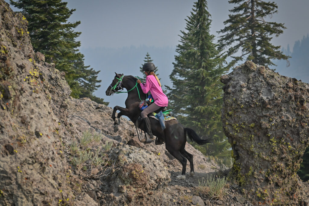
A quarter of the way along the ridge a horseback rider or hiker/runner might be surprised to find an obstacle that makes one wonder how anyone in the old days wanted to pass this way. A large volcanic cone outcropping with a steep and narrow passage and deep canyons on either side stands as a landmark known as Cougar Rock. Despite the poor footing hundreds of horses have traveled over this solid-based rock outcropping that resembles the shape of a cougar’s head. Over time riders and hikers have come to prize a photograph of themselves at this dramatic panoramic site.
Another difficult section of terrain along the ridge is a place called Elephant’s Trunk. The name reflects the trail’s resemblance to the profile of an elephant’s trunk: a slight dip and a steep incline, so sharp that a horse must climb for a few hundred feet up loose rubble and rock, on which, having a lava base, their flat shod hoofs fortunately do not slip. It is equally difficult for those afoot. A look back to the east finds the scenery positively breathtaking.
A short distance past Elephant’s Trunk you reach the Baker Ranch-Soda Springs Road. At this juncture the trail forks in two directions: The historic route of the Tevis Ride, to the southwest, crosses U.S. Forest Service (USFS) Road 96 to travel for 15 miles along Red Star Ridge and through the beautiful old growth forest of Duncan Canyon to Robinson Flat. This route is still used by our sister event, the Western States 100 Run. The other route, currently used by the Tevis ride, continues westward along the summit road of the Foresthill Divide for about 7 miles to reach Robinson Flat.
Although many consider Cougar Rock an integral part of the Tevis Cup Ride, there is a bypass trail available.
At the intersection of Red Star Ridge, the trail deviates south to a new “Red Star Ridge” vet check (gate and go only) location first used in 2016 (the former vet check was on Soda Springs Road).
The trail then rejoins the dirt and gravel Soda Springs Road for the remainder of the journey into the Robinson Flat vet check (one hour hold).
Robinson Flat to Last Chance
The trail between Robinson Flat and Last Chance has undergone several changes in the past 30 years.
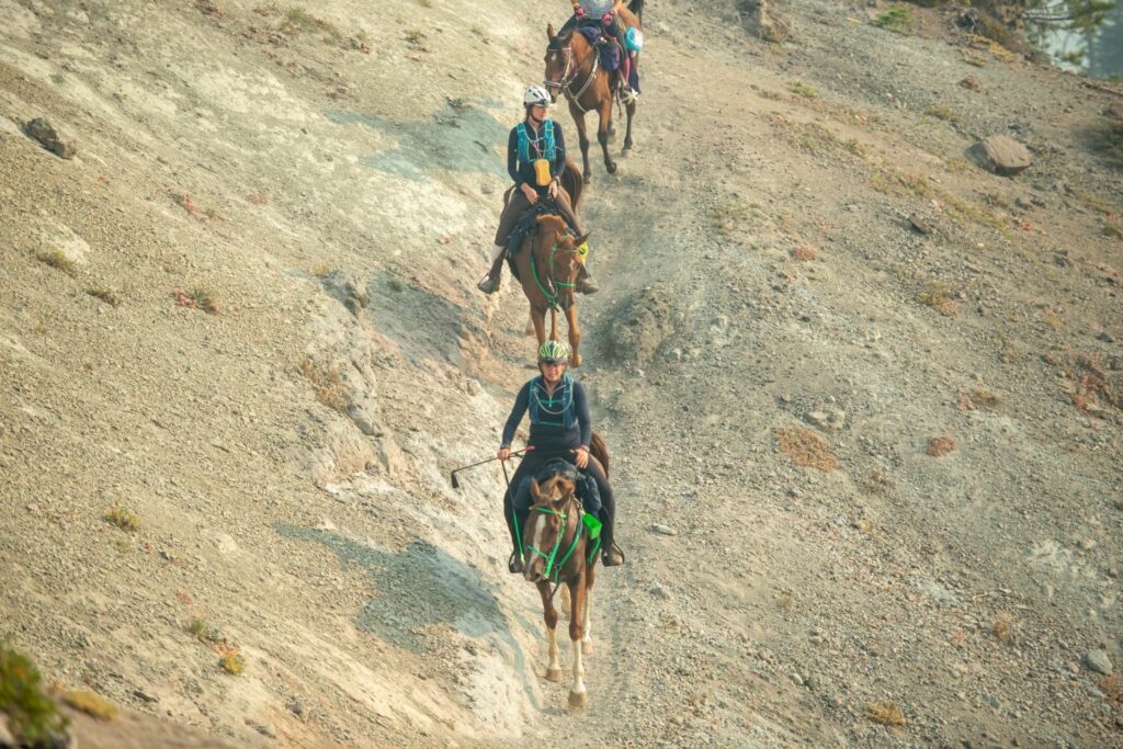
The current route follows a gravel road – a former wagon route used in the late 1800s – passing over a summit just to the south of Duncan Peak and to north of Little Bald Mountain. On a clear day, you can see all the way across the Central Valley to the Coastal Range and Mount Diablo 120 miles to the SW.
The route follows USFS Road 43 south nearly to Mosquito Ridge Road, before turning SW towards Dusty Corners and Last Chance. This turn is easy to miss if you’re not concentrating as the gravel road can be long and hot and cause you to lose focus.
Up until the early ’90s, the Western States Trail avoided Rd 43 by making its way westward along Barney Cavanaugh Ridge (also referred to or known as Cavanah Ridge). The ridge was named for a Last Chance miner, famous for discovery of the big Bonanza in the Klondike.
The Cavanaugh Ridge trail descends gradually while meandering along a ridge top, passing the site of a mining operation located a few hundred feet off the trail at Barney Pits. The historic trail continued through Deep Canyon and Grizzly Mine, however the Tevis route stayed on USFS Road 44, ascending back to Last Chance Rd.
After the Star Fire in 2001, a new route was cut into the south side of Duncan Peak, switchbacking across the south flank of the steep mountainside. This trail was used in 2009 (and possibly 2010?), but despite lovely views out towards French Meadows Reservoir, it proved too rocky due to the lack of topsoil from the burn and the ride returned to Rd 43.
For many years the trail used the infamous Pucker Point trail – well known for its astonishing views out over Screwauger Canyon – and the accompanying 1,000 foot drop straight down to the North Fork of the Middle Fork of the American River far below.
Following the American Fire in 2013, which burned from Deadwood to Robinson Flat – scorching the Pucker Point Trail, and burning the Swinging Bridge in its path – free-ranging cattle have caused much damage to the already delicate trail which is now more susceptible to erosion.
Although our sister event the Western States Trail 100 Run still uses the trail, in recent years, the Ride hasn’t been able to do so due to safety issues, instead remaining on Last Chance Rd all the way to the vet check.
The historic cabin – the last remaining indicator of the now-abandoned town – came close to also burning during the American Fire. Fire fighters were able to wrap it with fire-proof material and although the fire came right up to the adjacent trees, the cabin did not burn.
Alas, a few years later the cabin collapsed – some say due to snow pack, others say due to vandalism.
Founded in 1852, by 1884 the town boasted seven saloons… but today all that remains is the collapsed cabin, some old foundations, and miscellaneous artifacts hidden under the pine needles.
Perched on the top of an elevated promontory on the very brink of a tremendous drop-off, Last Chance is situated above the north fork of the Middle Fork of the American River between Grouse Creek on the south and Deep Canyon on the north in one of the wildest areas of this region.
Last Chance to Deadwood
This section of the Western States Trail was listed in the National Register of Historic Places on June 25, 1992, by the U.S. Department of the Interior. There are five interpretive signs along the trail to educate the public about the trail and its significance during the early development of this region and the Gold Rush.
It is worth noting the cooperative effort between the U.S. Forest Service, the Western States Trail Foundation and Western States Endurance Run Foundation that resulted in determining that this section of trail was eligible for listing in the National Register of Historic Places. An informative brochure is available at no cost from any of these non-profit organizations.
The path leading from Last Chance to Michigan Bluff was once a toll trail, with the toll collected by a Scotsman named Duncan Ferguson and his wife Jessie, who owned the hotel and bar at Deadwood called the Half-Way House. All of those using the trail — whether walking, riding horseback, driving cattle or pack trains — were asked to pay a toll, and the money was expended to keep the trail in good condition.
The trail from Last Chance follows a lumber road leading to the Pacific Slab Mine, which remained active longer than any other hydraulic mining operation in California. There are several cabins here, but the mine has not been worked for several years.
Here the narrow trail drops quickly down some 2,000 feet, which so many gold miners pioneered with picks, shovels and black powder.
It is not quite two miles down the switch back trail into the wooded canyon of the North Fork of the Middle Fork of the American River, with places so steep and stony that many riders dismount and run down, leading their horses.
When the trail was a toll route used by pack animals, occasionally those that crowded too fast on the trail would lose their footing and fall to their death in the canyon below. Watch carefully for the placement of your feet on the narrow trail.
At the bottom of the canyon is the so-called Swinging Bridge, suspended over the deep, swift flowing river. The water is crystal clear and the fishing grand. The thunder of the water is a pleasant sound.
In making the equally steep climb out of the canyon on well-graded switchbacks, riders will stop for perhaps a minute every three to four hundred yards, enabling their horses to catch their breath.
Near the top of the canyon wall is Devil’s Thumb, a landmark named for the hellish conditions that once existed here. The ‘thumb’ is a large volcanic rock outcropping standing nearly 50 feet in height.
Surrounding the ‘thumb’ is evidence of the Devil’s Basin hydraulic Sourdough and Basin mining pits that eroded the canyon side in the seemingly never-ending search for gold. Once in view of Devil’s Thumb you have nearly completed the long ascent from the deep canyon below.
The trail then follows the divide southwest toward the former town site of Deadwood, more than a mile from Devil’s Thumb. Deadwood is at the tip of this narrow mountain spur high above the yawning chasms of El Dorado Canyon and the North Fork of the Middle Fork of the American River.
Deadwood to Michigan Bluff
The trail from Deadwood leads past the cemetery into the gorge of El Dorado Canyon and steeply descends for three miles.
Through the grandeur of this towering hill and its awe-inspiring chasm meanders the tributaries of the Middle Fork, and the impressive jumble of rock and foliage spread out at the feet of the beholder.
It is considered a difficult and devious path, with steep inclines. The side of the canyon is abrupt and precipitous.
A third of the way down the canyon, you encounter Kaput Springs.
The Tale of Kaput
In 1966, a Nevadan named Cliff Lewis rode a 13-year-old, half-Arabian gelding named Kaput on the Ride. While riding down the trail from Deadwood Ridge into El Dorado Canyon, Cliff dismounted his horse as they stopped to get a cool drink of water at what was then called Holiday Springs.
Just as another horse and rider passed them, Kaput stepped too far backwards and suddenly tumbled over the side of the narrow trail and crashing through the vegetation and finally came to a stop on a small ledge.
Cliff hastily scrambled down the steep canyon wall to help his tangled and bruised horse, and stayed with him until the Drag Riders arrived. Since Cliff and Kaput were running near the front of the pack, it took a couple hours but Cliff kept quiet so as not to disrupt other riders’ experiences on that day.
The Drag Riders immediately radioed for help and a full-blown emergency rescue ensued.
That year a writer from Sport’s Illustrated magazine was at the Ride reporting on the “mighty Western States 100-Mile One-Day Trail Ride”.
Founder and President, Wendell Robie quickly swung into action by calling in a helicopter to come and rescue poor Kaput.
A harness was constructed not knowing if it would hold the horse but it did.
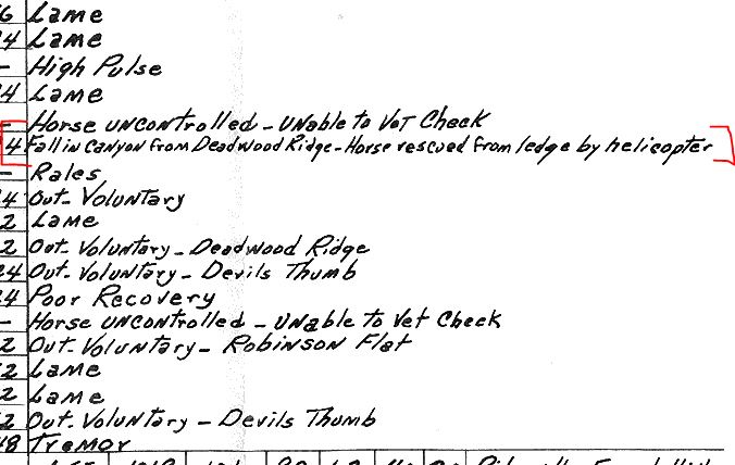
The photo was taken as he was being airlifted out of the canyon and ultimately to safety. The official comment on the Ride Results reads: “Fall into canyon from Deadwood Ridge – Horse rescued from ledge by helicopter.”
Ever since that day Holiday Springs has been called Kaput Springs.
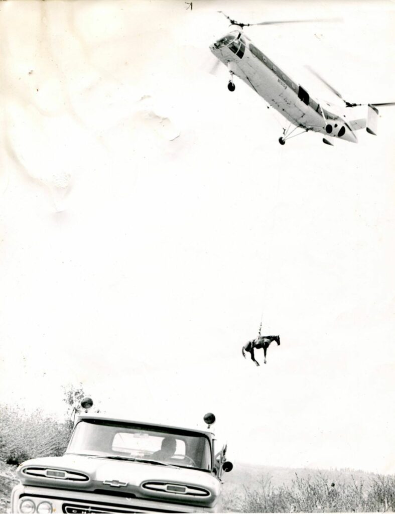
This Charlie Barieau photo ran in the
Sport’s Illustrated article as well as another article in The Western Horseman magazine.
The trail has since been widened and shored up at Kaput Springs to make it possible for several horses to stand sideways and drink, but savvy riders will still pay close attention along this section of narrow trail.
Well-constructed switch backs line the trail as it climbs out to a summit at the famous old mining camp of Michigan Bluff, some 2,000 feet above the river. The trail is cut into the steep sides of the canyon and is narrow, bounded on one side by the steep ascent, like a wall, and on the other by the precipitous descent to the river below.
There are fewer trees and more rock facing on this side of the canyon, making it seem larger, with views that are overwhelming. On a hot summer’s day, however, the trail takes on a different meaning. The heat generated from the bare rock facings coupled with the lack of shade trees can cause the temperature to rise by 10 to 20 degrees.